Algonquin Fire Towers
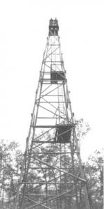
At one time there were at least 23 fire towers in Algonquin Provincial Park. One of the first was built on the top of a giant white pine at Smoke Lake which featured a rough observation platform at the top. A ladder at the base helped the climbers. Clearly safety concerns were not an issue. The tallest wooden fire tower in Ontario, the “Summit tower”, was located at the summit of the Ottawa, Arnprior and Parry Sound Railway (near the old Booth railway at Hunter Twp. north of the nearby sawmill village of Brule Lake). It was reported to be 31 metres (102 feet) high. It was built in the 1920s by Algonquin Park’s Chief Forest Ranger Tom McCormick who knew Tom Thomson, the famed painter. Apparently McCormick referred to Thomson as a ‘bum’.
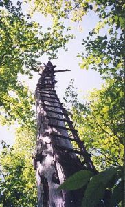
By 1960 there were only 9 towers, all of steel construction, on active duty. The last fire tower was the Big Crow Lake tower built in 1956. The cupola (the building at the top of a tower) burned following a lightning strike in 2010.
The use of lookout towers in Ontario to search for forest fires was common in the 1920s. The first fire tower lookouts were wooden and erected following WW1. Their height ranged from 35-60 feet. As the forest grew the wooden towers were replaced with 80 ft. steel structures. In time the towers were grouped into 22 individual Ontario Fire Districts such as Tweed, Parry Sound, North Bay and Sudbury. The Department of Lands and Forests, which transitioned to the MNR in1972, would place cameras on 100 ft. poles and take pictures to determine the best place for an observation tower. It took about two weeks to erect a tower which started at the cement block base; not a job for the faint of heart as the production proceeded. This reminds me that trapper friend Norm Layland and Terry Simpson, his assistant, spent one summer painting the roofs of cupolas.
Some parts were dropped by plane in the winter and others hauled in by horse in the spring. The steel pieces were bolted at each level. The top cabin, the cupola, was hoisted piece-by-piece. Earlier efforts had a tendency to sway and shift in higher winds and the odd one not properly bolted blew over. As of 2023 the MNR is now called the Ministry of Natural Resources and Forestry (MNRF).
The early forest rangers carried out patrols in their assigned areas as well. Forest Ranger Henry Taylor who lived past the century mark used to laugh that he was driving around in his Model A Ford enforcing the fires laws – without a drivers license.
Tower men, and women, worked seasonally from May 1 to October 1 depending upon the weather. They worked long daylight hours during the summer when the fire index was high. Doug Mumford, retired L&F, explained that “most fires were located by using two towers giving the location of a fire on their map based on a 360 degree radius and we could pinpoint the degrees given to us by several towers to get the exact location of a fire.”
An Alidade, mounted on a circular table with a map of the area and a degree ring to plot fire direction, determined the location of the fire. The tower could then report a compass direction, distance and fire size to HQ by ‘bush phone lines’ in the early days and by two-way radio later. At HQs if more than one tower reported the fire they could ‘fix’ its location.
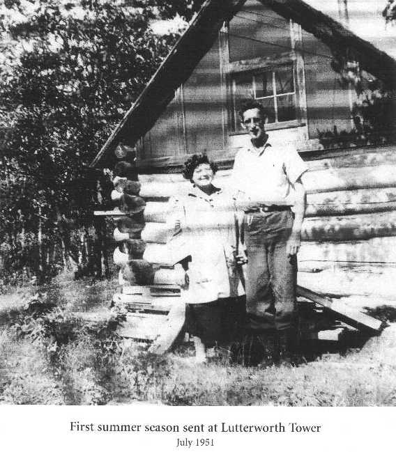
Commuting was not often an option. This was not an ideal occupation for a family. One exception, Mrs. Gloria Weight, said “as far as I know I was the only wife who got to spend the summer at a fire tower. I cooked on a little gas stove and met visitors to the tower. We raised our son there in the summer and he climbed the 85 foot tower by the age of one. We only got to go into town for food and paycheques once a month during a rainfall.” Her husband was located at the Lutterworth Fire Tower at Moore Falls, Haliburton.
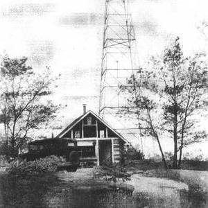
From another source, the accompanying photos of the devils/Lutterworth Lake fire tower identifies the couple as Gloria and Angus Cameron in 1951, their first year at this tower. Information states their son was born there and taken up the tower in his first year. “Gloria always had cream and freshly picked fruit for guests.”
The isolation had a certain appeal to writers, artists and musicians. Some would play their instrument, such as a fiddle, over their radio for other towers when the fire index was low. Sometimes unknowingly because they pressed the wrong switch.
Tower men were expected to keep a daily log and some kept a guestbook. They also kept a very long rope to tie to any visitor who became frightened at the prospect of climbing down. All logs were to be handed in to the DL&F at the end of the season. The Maple Mountain (see my other fire towers article) diary was perhaps an exception.
Algonquin P.P. Fire towers
From a map (goto: Ontario(a)s Fire Tower Lookouts) circa 1922 one could see the location of the following fire towers: Big Crow Lake, Booth(a)s Farm on Farm Lake, Cache Lake, Depot Lake, Gibsons Lake, Grand Lake, Indian River, Island Lake, Lister Tower, Lake Lavielle, Lake Travers, Little Cauchon Lake, Manitou Lake, Martino Lake, Osler Lake, Rock Lake, Smoke Lake (2 towers), Southworth Lake, Summit Tower, Tims Lake, Trout Lake, White Trout Lake, and Wilson Lake.
As of 2013 the Algonquin Visitor Centre has featured a boardwalk called the “Fire Tower Trail” which leads to a reconstructed cupola courtesy of the Algonquin College Carpenter Apprentice Program and the Fire Rangers of the OMNR. Some history:
Big Crow
The fire ranger’s cabin, boathouse and fire tower were built, as previously mentioned, in 1956. The tower was located about half a mile up a steep hill from the cabin. These were among the last to be built and last to be used. The Big Crow tower was employed until the mid-1970s.
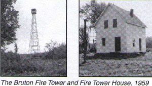
Bruton Tower
The 80 foot steel tower, located on the Bruton Farm, served from the 1930s-1970s.
Osler Township Fire Lookout Tower
In 1962, to accommodate the towerman, the L&F built the Birchcliffe Ranger cabin and fire tower. The tower sat on a hill that had a 10 mile visibility circle and it was within a 15 mile circle of high incidence of lightning fires. The lake was chosen because it had road access and planes could land. The old fire location was a long 2-mile walk from the cabin. Ranger labour built the tower (at a cost of $2800) and cabin ($2900).
Since the towers decommissioning it has served Interior maintenance crews and the general public. In 1994 The Friends of Algonquin Park volunteered to carry out major repairs to the cabin.
The Preston Fire Tower
The tower, built in 1932, was moved from the less satisfactory location of Kitty Lake which was built in 1922. Housing was provided by the Tattler Lake Ranger cabin. The new tower was situated on a hilltop about 1.5 miles west of the cabin. At an elevation of 1900 feet it was the highest spot in all of A.P. The cabin was located on the old No.3 Camp of the J.R. Booth Lumber Company. Booth’s men helped move the tower’s components to the new site and may well have contributed material and labour to building the cabin.
An old park archives report states that by 1964 the tower swayed “quite noticeably in the wind”, the roof needed fixing “because in winds one side lift up” and the cabin was “snake infested and logs are beginning to rot”.
The Preston fire tower was probably last used in 1970. All historic Park sites were evaluated between 1971 – 1973. The 1973 report on the Tattler Lake cabin commented on improvements to the cabin by portage crews and canoeists including a new roof. “Prospective users need not worry about snakes or rot.”
The Skymount Fire Tower
This tower, no longer in existence, is part of a 7.7 km trail complete with numbered posts and a corresponding descriptive guide text. It is located 25 km from the West Gate or 31 km from the East Gate along Highway 60. Ambitious, as in fit, hikers will see “outstanding examples of Algonquin Park scenery and history.” The main loop includes the location of the former Skymount tower and a view over Cache Lake. There is also an optional 5.5km side trail off the main loop that leads east along the old rail bed to the Highland Backpacking Trail, the former Two Rivers airfield and Mew Lake where the moose lifts during the 1980s took place.
For more information goto: Ontario(a)s Fire Tower Lookouts. Last I knew the MNRF airbase for its Beaver aircraft is at Smoke Lake.
